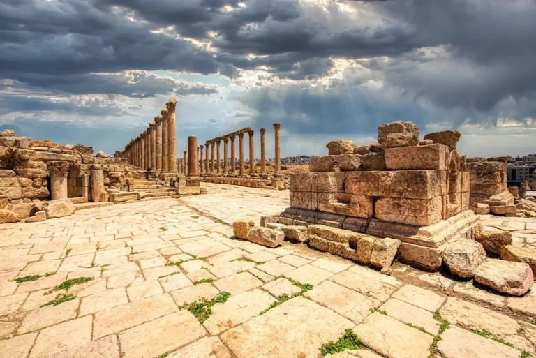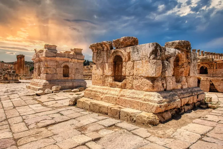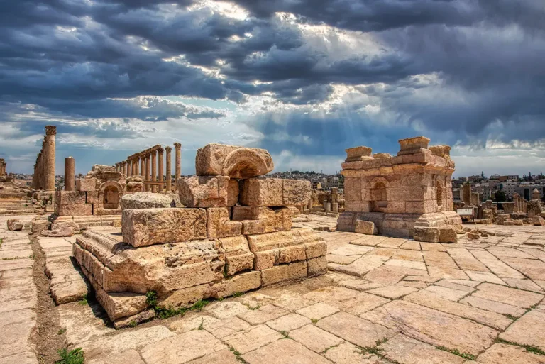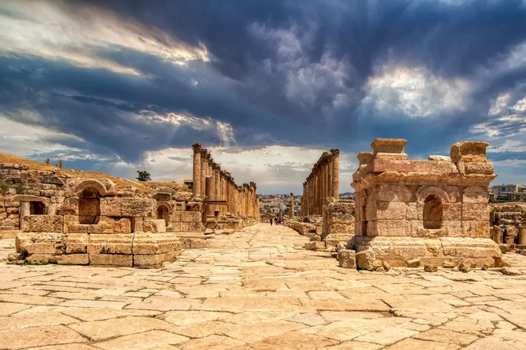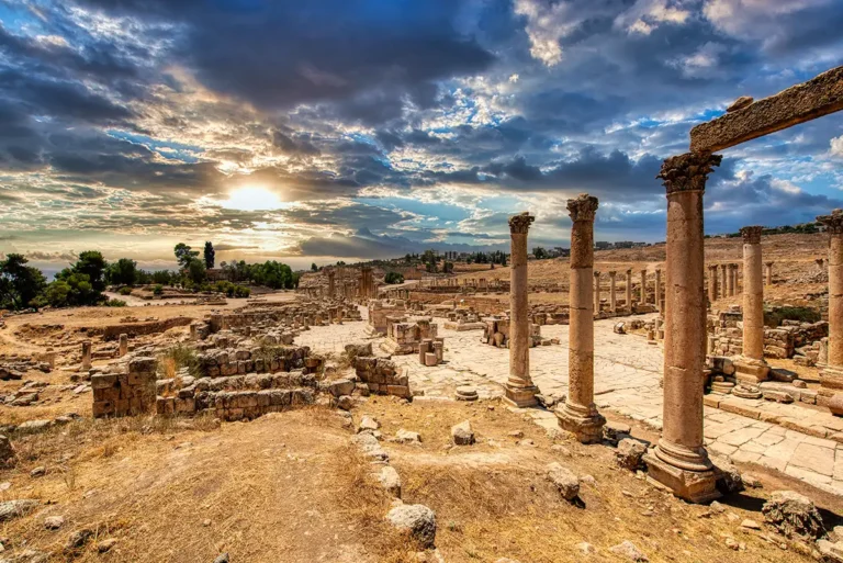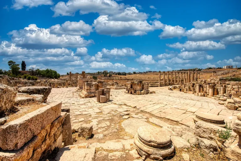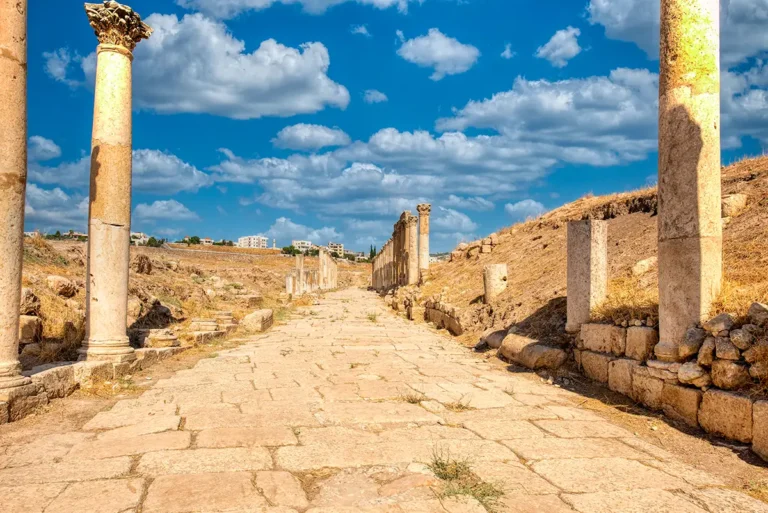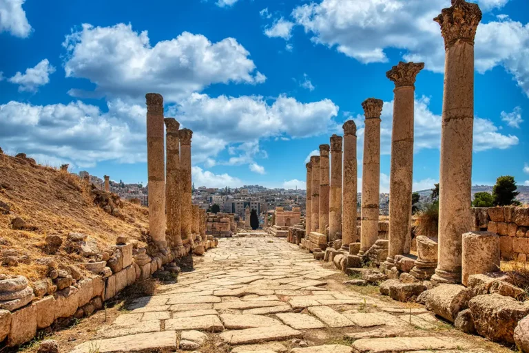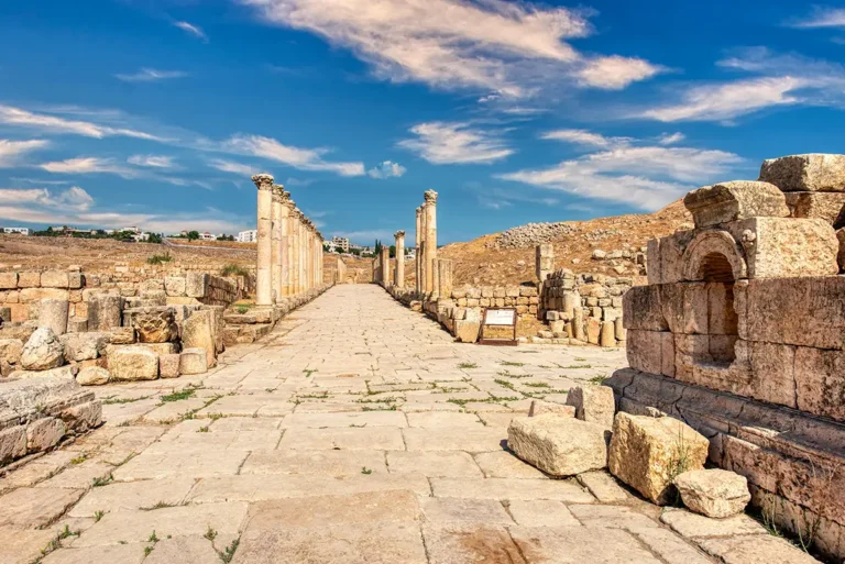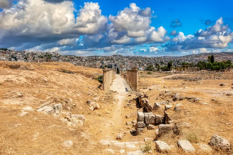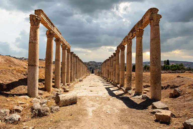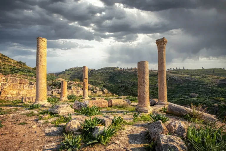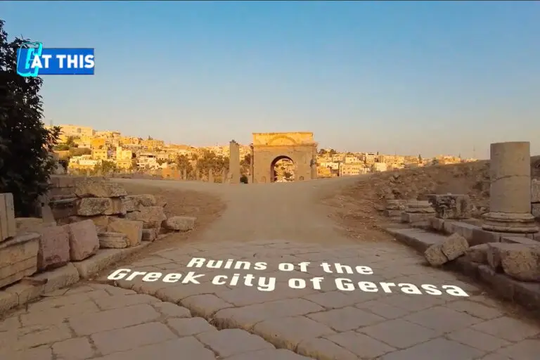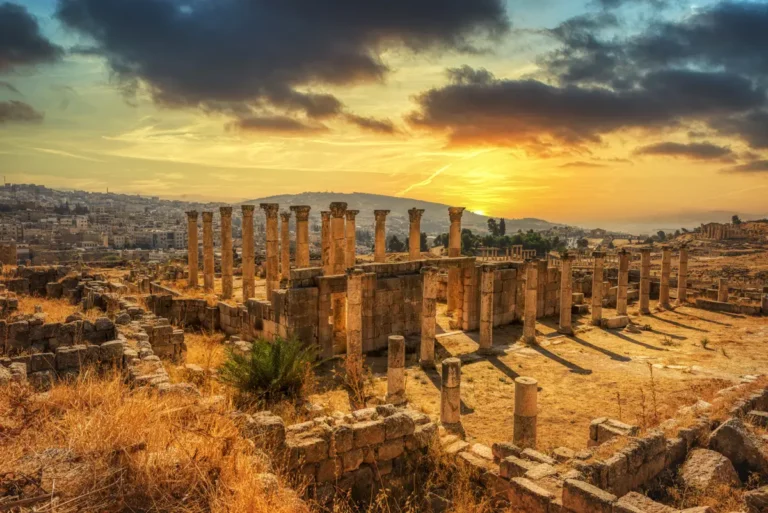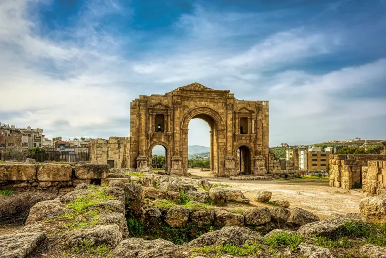
The South Tetrapylon and South Decumanus mark one of the most important crossroads in ancient Gerasa. Here, the Cardo Maximus—the great north–south collonaded avenue—met a principal east–west route. The intersection lay just north of the Oval Plaza and beside the Macellum, placing it within one of the busiest commercial and ceremonial areas of Roman Jerash.
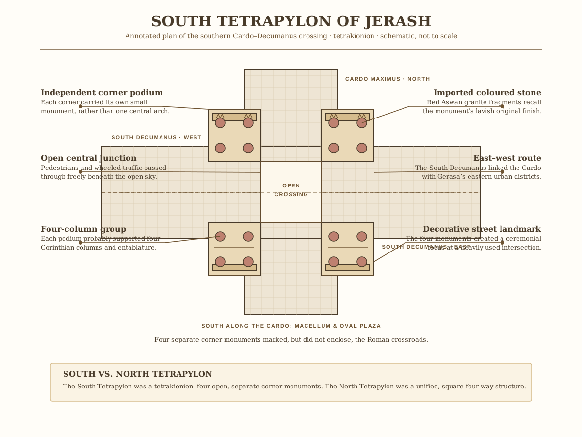
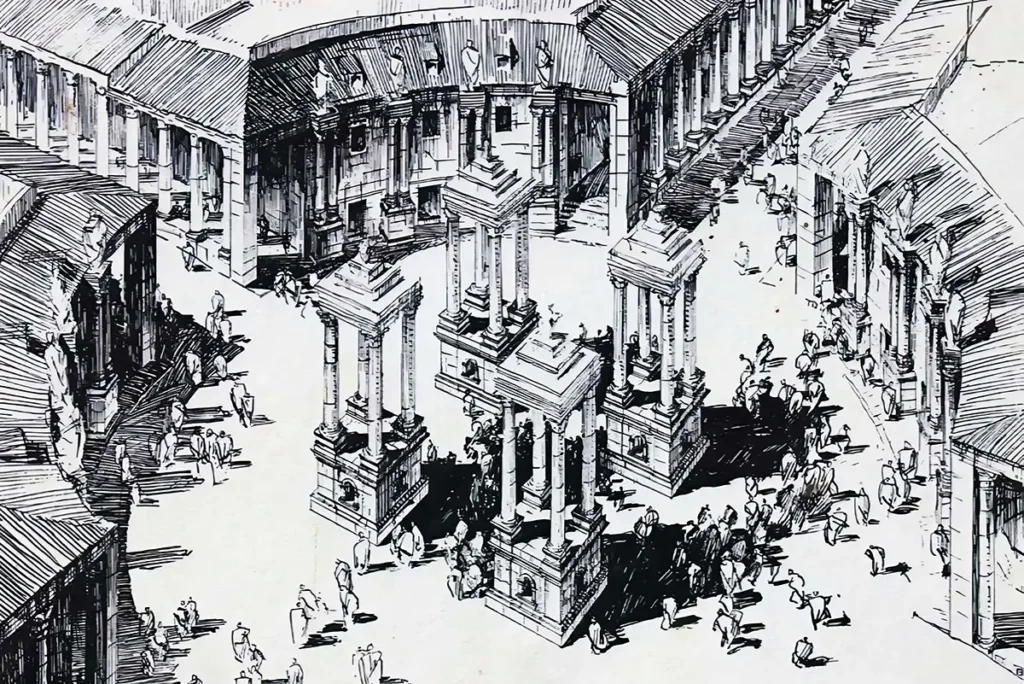
The name “South Tetrapylon” can be slightly misleading. Unlike the North Tetrapylon, which was a unified four-way structure with passages through its centre, the southern monument was probably a tetrakionion: four separate, tower-like corner monuments set around an open crossing. Together, they gave architectural grandeur to the intersection without blocking movement through it.
The South Tetrapylon & Decumanus at a Glance
Location: Jerash Archaeological Park, Jordan (at the junction of the Cardo Maximus and South Decumanus, north of the Oval Plaza)
Built date: Late 2nd century AD (around 180–200 AD, during the Severan Period)
Purpose: A monumental crossroads plaza, decorative landmark, and central commercial market junction
- Type: A tetrakionion—four separate corner monuments around an open intersection
- Architectural Style: High Roman Imperial style featuring a tetrapylon (four-structure monument) framing a circular plaza
- Key Feature: Four matching monumental stone pedestals that originally supported colossal statues of Roman emperors
- Street connection: The South Decumanus linked the Cardo with the eastern side of the city and the wider urban area beyond
- Nearby monuments: Umayyad Mosque, Macellum, Oval Plaza, the Cathedral and the Nymphaeum
- Current Status: Fully excavated and extensively restored ruins open to the public.
First Impressions
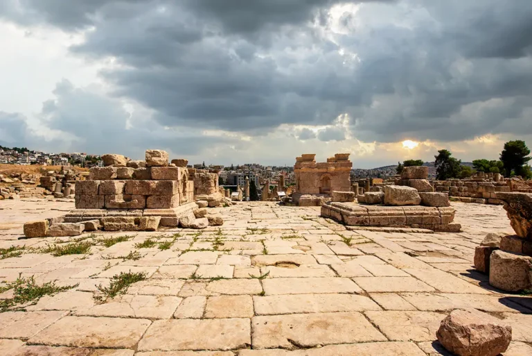
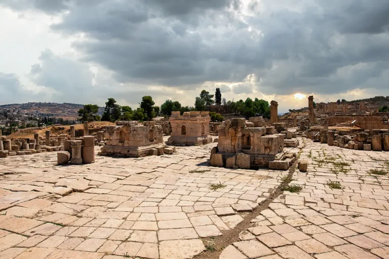
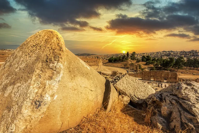
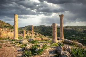
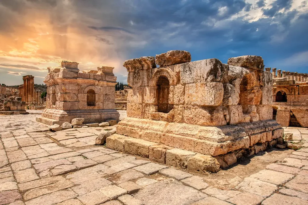
At first glance, the South Tetrapylon can seem less dramatic than Jerash’s great gates, theatres or temples. Its power lies in the layout. The crossing opens broadly around you, with the Cardo continuing north and south and the South Decumanus cutting across it. Low podiums and architectural fragments mark the four corners, allowing you to imagine a former display of columns, coloured stone and statuary against the traffic of the city.
This was not a gate in the city wall. It was an internal urban landmark—a place designed to slow the eye, frame movement and make the crossing feel important. The open centre allowed carts, animals and pedestrians to pass freely, while the four corner monuments created a visual signal that the visitor had reached a major intersection.
Historical Context and Origin
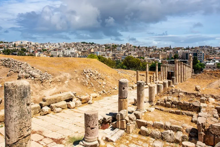
Gerasa’s Roman street network developed over generations. The Cardo Maximus formed the principal north–south spine, while decumani created east–west connections across the city. These streets were not simply practical routes: they were formal public spaces, paved in limestone, lined with colonnades and connected to temples, markets, theatres and civic buildings.
The South Tetrapylon was created to monumentalise the southern crossing of the Cardo and South Decumanus. Its exact construction date remains uncertain, but its form belongs to the Roman-period remodelling of the city’s streets and public spaces, most likely in the late 2nd or early 3rd century AD. Unlike an arch that one passed through, it was an open arrangement of four matching corner monuments.
The wider district continued to change in Late Antiquity. Commercial spaces, churches and domestic buildings altered the Roman street frontage, while some older monuments were repaired, dismantled or reused. In the Umayyad period, parts of the Cardo and nearby buildings were adapted for workshops and housing, showing that the crossing remained within an active urban landscape long after the Roman city had changed.
Where Are the South Tetrapylon & Decumanus?
The South Tetrapylon stands on the Cardo Maximus, just north of the Macellum and a short walk north of the Oval Plaza. It marks the crossing with the South Decumanus, an east–west street that connected the centre of Gerasa with buildings and neighbourhoods on either side of the main avenue.
From the Oval Plaza, walk north along the Cardo. The Macellum lies to the west, occupying the block between the plaza and the tetrapylon. Continue a little farther to reach the open crossing. From here, the South Decumanus leads east toward the former eastern districts of Gerasa, while its western branch brings you toward later church complexes and other urban remains.
What Is a Tetrakionion?
A tetrakionion is a monument formed from four architectural elements placed at the corners of a crossing. The word is related to Greek terms for “four columns” or “four pillars.” From a distance, the four monuments work together as a single composition; at ground level, however, the intersection remains open.
The South Tetrapylon of Jerash is best understood in this way. Each corner likely had a raised podium supporting a group of columns, rather than one enclosed central structure. The crossing therefore remained a functional street junction while also becoming a ceremonial space.
This distinguishes it from Jerash’s North Tetrapylon:
North Tetrapylon: A unified square monument with openings on all four sides
South Tetrapylon: Four separate corner monuments around an open centre
That difference is important. The North Tetrapylon enclosed and framed the crossing; the South Tetrapylon decorated the crossing while leaving its centre completely open.
Architectural Design and Features
The South Tetrapylon is an exceptional example of a plaza-style crossroads, beautifully engineered to merge heavy transit functionality with imperial political propaganda.
The Four Corner Podiums
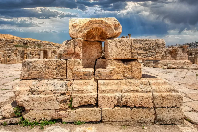
The surviving evidence indicates four substantial podiums, one at each corner of the junction. These bases were the foundations for the monument’s visual impact. Raised above street level, they would have made the intersection legible from a distance along the Cardo and the South Decumanus.
The podiums probably carried groups of four columns, producing four small but elaborate architectural towers. Their symmetry gave the crossing an ordered Roman appearance and helped organise the views along the two main streets.
Corinthian Columns and Decorative Stone
The column groups were likely Corinthian, the most ornate of the classical orders. Corinthian capitals, carved with acanthus leaves, were especially suited to a monument intended to display refinement and prosperity.
Fragments associated with the South Tetrapylon include imported coloured stone. Notably, red granite from Aswan in Egypt has been identified among the monument’s columns. The use of such material was a statement of wealth and connection: Gerasa was far from Egypt, yet its public architecture incorporated prestigious materials moved through imperial trade networks.
An Open, Unroofed Crossing
Unlike a conventional arch or gate, the South Tetrapylon did not create a covered passage. The central crossing remained under the open sky. Its four corner monuments acted like architectural punctuation marks, turning the meeting of streets into a plaza-like space.
This form was especially effective for a busy Roman city. It allowed movement to continue in all directions while surrounding that movement with columns, sculpture and decorated façades.
The South Decumanus: Gerasa’s East–West Route
The South Decumanus was one of Gerasa’s important east–west streets. It intersected the Cardo near the southern civic and commercial core, close to the Oval Plaza, Temple of Zeus and South Theatre.
The street’s eastern branch led toward the city’s eastern side, crossing the landscape of the Wadi Jerash and connecting with districts that extended beyond the most heavily visited ruins. The western branch joined a zone later transformed by churches, domestic buildings and Umayyad occupation.
Like the Cardo, the street was paved and served by drainage infrastructure. Manhole covers and drains are reminders that Roman streets were engineered systems, designed to manage rainwater and heavy daily use. The South Decumanus was not a secondary back lane; it was part of the circulation network that connected the commercial heart of Gerasa with the rest of the city.
A Crossroads of Trade, Procession and Daily Life
The South Tetrapylon stood in a particularly active area. The Macellum occupied the block between the Oval Plaza and the crossing, while the Cardo carried pedestrians, traders and processions between the city’s principal monuments.
The nearby Macellum was a purpose-built food market, constructed near the end of the 2nd century AD. Its octagonal court, fountain, porticoes and market exedrae show how closely commerce and monumental architecture were linked in Gerasa.
For a person walking north from the Oval Plaza, the sequence would have been carefully staged:
The colonnades of the Cardo led away from the oval space.
The Macellum introduced a busy commercial quarter.
The South Tetrapylon announced the major east–west crossing.
The South Decumanus opened routes into other sectors of the city.
This was urban design as theatre. Streets were built for transport, but they were also spaces in which Gerasa displayed order, wealth and civic confidence.
Beyond the South Tetrapylon
The Macellum
Immediately south of the crossing, the Macellum was Gerasa’s food market. Its position made practical sense: it stood beside the Cardo, close to the Oval Plaza and at a major junction where goods, customers and information moved through the city.
The Oval Plaza
A short walk south brings you to the Oval Plaza. Its unusual shape connected the Cardo with the rising approach to the Sanctuary of Zeus. Together with the South Tetrapylon, it shows how Gerasa used changes in street width, direction and monumentality to guide visitors through the city.
Sanctuary of Zeus and South Theatre
To the west and south-west, the Sanctuary of Zeus rose above the plaza, while the South Theatre stood nearby. These monuments gave the southern centre of Gerasa its religious and cultural character. The South Tetrapylon connected this monumental zone with the wider street network.
East Market and Eastern Districts
East of the Cardo lay market areas, residential districts and routes toward the Wadi Jerash. The South Decumanus was one of the links between the formal Roman centre and these broader urban spaces.
Destruction, Reuse, Rediscovery and Restoration
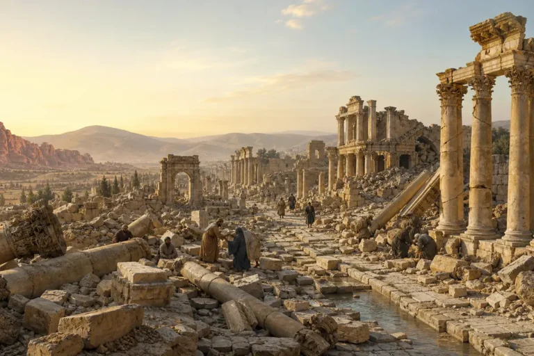
The South Tetrapylon and the surrounding commercial avenues suffered catastrophic structural failures during the historic Galilee earthquake of 749 AD. The violent horizontal tremors caused the high stone canopy structures to collapse inward onto the circular intersection, sending the massive Corinthian columns and imperial statues crashing down onto the roadway. Over the subsequent medieval centuries, windblown silt and dirt from the adjacent hillsides filled the circular depression of the plaza, burying the paving slabs and lower portions of the pedestals beneath meters of soil.
The monument was systematically brought back to light during the major international excavations of the 20th century. Recognising its unique contribution to Roman urban topology, the Jordanian Department of Antiquities, alongside international engineering teams, launched an intensive stabilisation and reconstruction campaign.
Using the architectural method of anastylosis, restorers cleared the buried intersection, meticulously realigned the fractured paving slabs, and re-erected several of the monumental column clusters framing the four central pedestals, allowing modern travellers to clearly navigate the grand roundabout once again.
What to Look For
The four corners: Identify the separate podiums rather than looking for a single central arch.
The open crossing: Notice how the streets pass through the middle under open sky.
Column fragments: Look for evidence of the richly decorated original architecture.
Different stone colours: Red granite fragments recall the monument’s expensive imported materials.
Street paving and drainage: The worn limestone slabs preserve the practical side of Roman urban engineering.
The Macellum to the south: Its location explains why this crossroads was commercially important.
The long view along the Cardo: Stand at the crossing and look north and south to appreciate the Roman planners’ use of perspective.
The South Tetrapylon Today
The South Tetrapylon is not a fully reconstructed monument, and that is precisely why it can be rewarding. Its surviving bases allow the street plan to remain visible. Rather than presenting a complete façade, the ruins invite you to imagine the crossing as a place of movement: people coming from the Oval Plaza, traders leaving the market, carts crossing east and west, and visitors looking along the collonaded Cardo.
It is also a useful stop for understanding the scale of ancient Gerasa. The city was not composed only of isolated “attractions.” Its streets, markets, fountains, sanctuaries and public monuments were designed as connected parts of a living urban system.
Practical Visiting Tips
Visit the South Tetrapylon as part of a walk between the Oval Plaza and Macellum.
Compare it directly with the North Tetrapylon later in your visit; the contrast between a tetrakionion and a unified tetrapylon becomes much clearer.
Look at the paving before photographing the podiums—the road surface explains the monument’s real function as a crossroads.
Visit in the morning or late afternoon, when side light makes the low architectural remains easier to see.
Wear sturdy shoes; paving around the crossing is uneven.
Allow 10–15 minutes for the monument itself, or longer if you are tracing the South Decumanus and nearby commercial quarter.
Respect barriers and avoid climbing on podiums or fallen stones.
Why the South Tetrapylon & Decumanus Matter
The South Tetrapylon and South Decumanus show Roman Gerasa at the scale of everyday urban life. The crossing brought together trade, processions, movement and civic display near the city’s commercial and ceremonial heart.
Its remains may appear modest beside the Temple of Zeus or the South Theatre, but they reveal something equally important: Roman cities were designed as connected experiences. A visitor did not simply arrive at a monument. They moved through paved streets, passed market stalls, entered framed intersections and encountered a sequence of spaces that made Gerasa feel wealthy, organised and unmistakably Roman.
Frequently Asked Questions
No. It stood inside the city at a major crossroads. It was a ceremonial and urban monument, not part of the defensive wall.
“South Tetrapylon” is the traditional name. More precisely, it was likely a tetrakionion: four related corner monuments that worked together as one architectural composition.
No central roof is expected. The four corner monuments stood around an open intersection, allowing the Cardo and South Decumanus to remain clear for traffic.
The exact reconstruction is uncertain, but each corner probably had a podium carrying four Corinthian columns and decorated upper stonework. Imported coloured stone, including red granite, added to its visual richness.
The North Tetrapylon was a unified, square, four-way structure with openings through it. The South Tetrapylon consisted of four separate corner monuments around an open crossing.
Key Moments in History
Early 2nd century AD — Gerasa’s street grid takes shape.
The Cardo Maximus became the city’s main north–south avenue, while the South Decumanus developed as an important east–west connection through the southern civic and commercial district.
Later 2nd or early 3rd century AD — The southern crossroads is monumentalised.
Four separate corner monuments were erected at the junction of the Cardo and South Decumanus. Together, they formed the South Tetrapylon, more accurately described as a tetrakionion: an open four-part monument rather than a single four-way arch.
Key Moments in History
Early 2nd century AD — Gerasa’s street grid takes shape.
The Cardo Maximus became the city’s main north–south avenue, while the South Decumanus developed as an important east–west connection through the southern civic and commercial district.
Later 2nd or early 3rd century AD — The southern crossroads is monumentalised.
Four separate corner monuments were erected at the junction of the Cardo and South Decumanus. Together, they formed the South Tetrapylon, more accurately described as a tetrakionion: an open four-part monument rather than a single four-way arch.
Roman imperial period — Imported stone enhances the monument.
The South Tetrapylon incorporated prestigious coloured materials, including red granite brought from Aswan in Egypt. Its columns and decorated upper elements turned a practical traffic junction into a visual statement of Gerasa’s wealth and Roman connections.
Late 2nd century AD — The surrounding commercial quarter expands.
The Macellum was built in the block between the Oval Plaza and South Tetrapylon. Its market court, fountain and porticoes made the area a busy meeting point for traders, shoppers and visitors moving along the Cardo.
4th–6th centuries AD — The Roman streets are adapted in the Byzantine city.
Churches, houses and new public uses changed the district around the South Decumanus. Older architectural blocks were repaired, reused or incorporated into later structures as Gerasa’s religious and urban life evolved.
7th–8th centuries AD — Umayyad occupation reshapes the area.
Parts of the southern Cardo and neighbouring buildings were reused for workshops, housing and other practical activities. The former Roman crossroads remained part of an inhabited town rather than becoming an immediately abandoned ruin.
AD 749 — Earthquake damage devastates the city.
The great earthquake caused widespread collapse across Jerash. The exposed columns and decorated upper elements of the South Tetrapylon were especially vulnerable, leaving the podiums and scattered fragments visible today.
20th century to today — Excavation reveals the tetrakionion plan.
Archaeological study clarified that the South Tetrapylon was composed of four separate corner monuments, not a single central arch. Its surviving bases now help visitors understand the scale and sophistication of Roman street design in Gerasa.