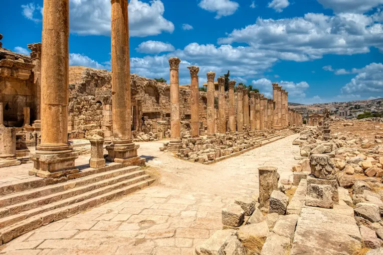
The Cardo Maximus was the main north–south street of ancient Gerasa, the Roman city now known as Jerash. Stretching for roughly 800 metres (about 2,625 feet) through the archaeological site, it was the city’s monumental spine: a broad paved avenue lined with columns, shops, public monuments, baths, churches and intersections. To walk it today is to follow the route that organised the daily life of Roman and later Byzantine Jerash.
The Cardo Maximus at a Glance
Location: Jerash Archaeological Park, Jordan (connecting the Oval Plaza to the North Gate)
Built date: Developed from the 1st century CE and modified through the Roman and Byzantine periods
Purpose: Main colonnaded avenue of ancient Gerasa
- Length: Approximately 800 metres (about 2,625 feet)
- Architectural Style: High Roman Imperial urban planning featuring monumental colonnades and intersections
- Key Feature: Original stone pavement scored with deep ancient chariot wheel ruts and an advanced subterranean sewer network
- Nearby monuments: Oval Plaza, Macellum, Cathedral, Nymphaeum, Sanctuary of Artemis, North Gate
- Current Status: Extensively restored walking thoroughfare; serves as the main directional axis of the site.
First Impressions
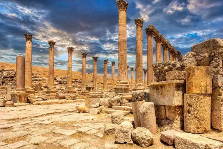
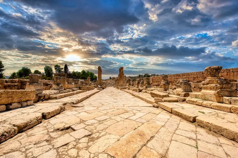
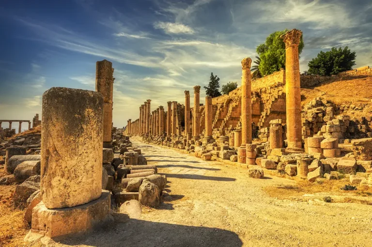
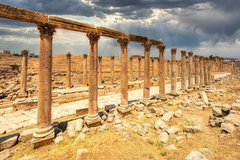
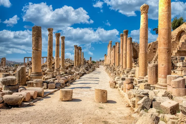
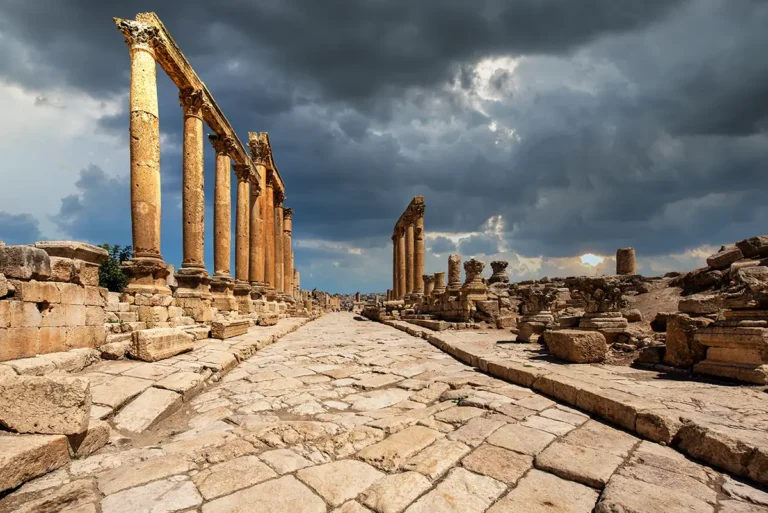
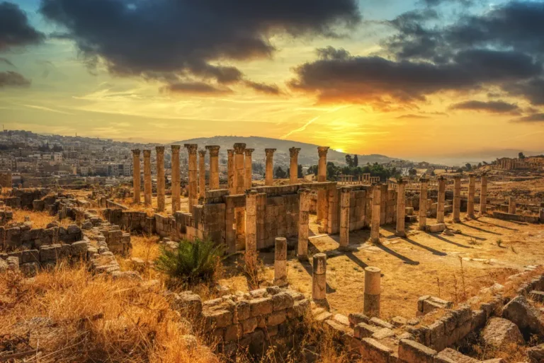
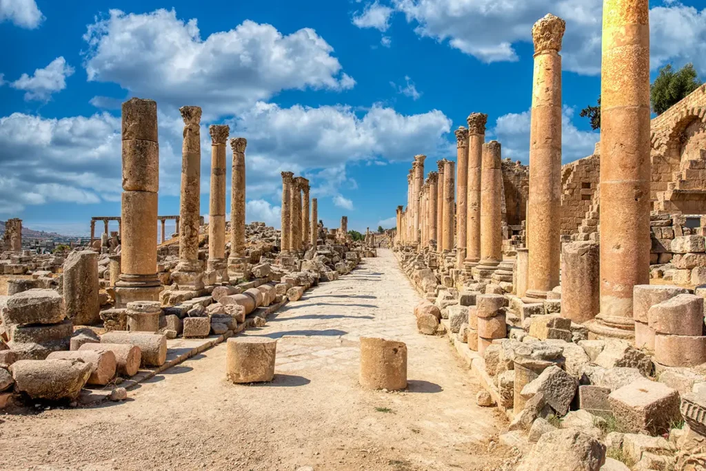
The Cardo Maximus creates one of Jerash’s most unforgettable views: a long, nearly straight avenue of pale paving stones and upright columns drawing the eye toward the distance. From the Oval Plaza, it begins as a formal continuation of the city’s southern ceremonial district, then leads north through a dense landscape of monuments and ruins.
At ground level, the street feels surprisingly human in scale. The paving is uneven in places, the columns rise in irregular rhythms, and the remains of shops and porticoes sit close to the walking route. It is easy to imagine a city of pedestrians, traders, carts, animals, officials and worshippers rather than a silent archaeological site.
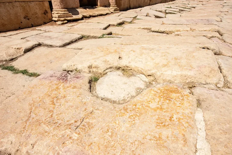
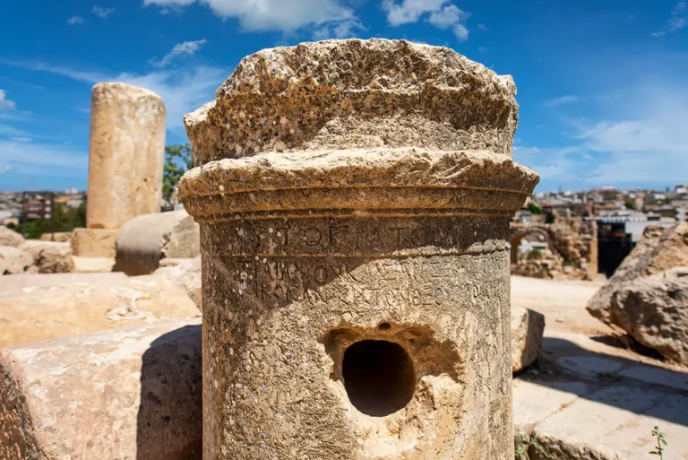
Look down as well as ahead. Deep lines cut into some paving slabs preserve the tracks of wheeled traffic. Nearby, stone covers and openings mark the drainage network below. These small details make the Cardo especially compelling: it was not only built to impress, but to carry the everyday movement, water and commerce of a busy provincial city.
Historical Context and Origin
The Cardo emerged as Gerasa developed into a major Roman city in the 1st century CE. A cardo was the principal north–south axis in Roman town planning, and the Cardo Maximus of Jerash became the city’s most important street.
Its construction and embellishment occurred in phases. The avenue was lined with colonnades and monumental buildings as Gerasa prospered in the Roman period, particularly after the city became part of the Roman province of Arabia in 106 CE. The Cardo linked the city’s sacred, commercial and civic districts, helping turn a growing settlement into a coherent monumental city.
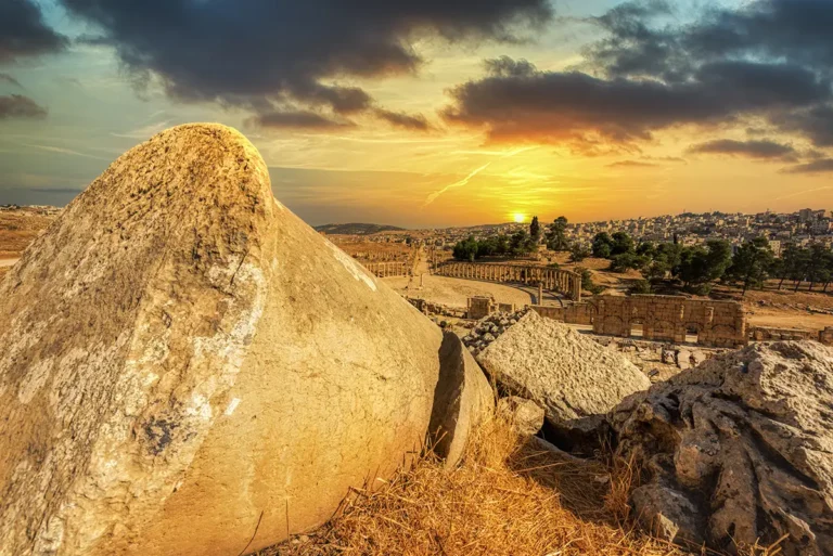
The Oval Plaza at its southern end was a particularly ingenious addition. Since the Cardo and the approach to the Sanctuary of Zeus were not aligned, Roman planners used the oval space as a graceful transition between the straight street and the temple precinct. Rather than ending abruptly, the Cardo opened into a curving ceremonial plaza.
The street remained important in late antiquity. New churches, workshops and urban structures appeared along or near it, while the paving and drainage system continued to be repaired and reused. Even as the city changed after the Roman period, the Cardo remained one of the main lines through which people moved across Gerasa.
Architectural Design and Features
The Cardo Maximus stands as an extraordinary masterclass in Roman civil engineering, designed to balance heavy foot traffic, intensive commercial activity, and harsh seasonal weather.
The Paved Roadway
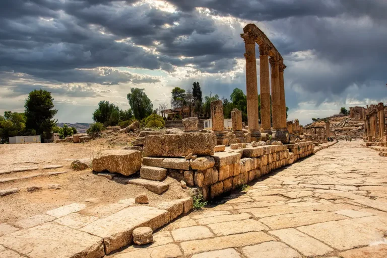
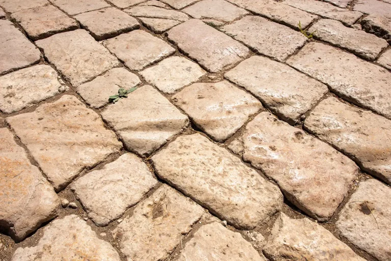
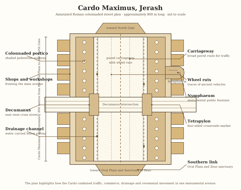
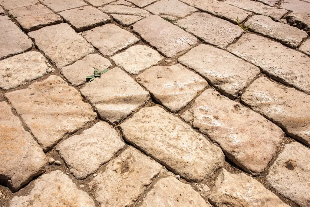
The central roadway was surfaced with large limestone slabs, forming a durable route for pedestrians, animals and wheeled vehicles. Many slabs remain in place, although centuries of traffic, earthquake damage, repair and weathering have given the surface its uneven character.
The road was wide enough to function as a major urban thoroughfare, but it was not an empty ceremonial avenue. Its paving supported constant movement through the city: goods arriving at shops, people heading to temples or baths, officials moving between public buildings and visitors entering from the city gates.
The wheel ruts visible in the stone are among the most immediate traces of that movement. They show how repeated traffic wore grooves into the paving over time, transforming an abstract Roman street plan into physical evidence of a working city.
The Colonnades and Sidewalks
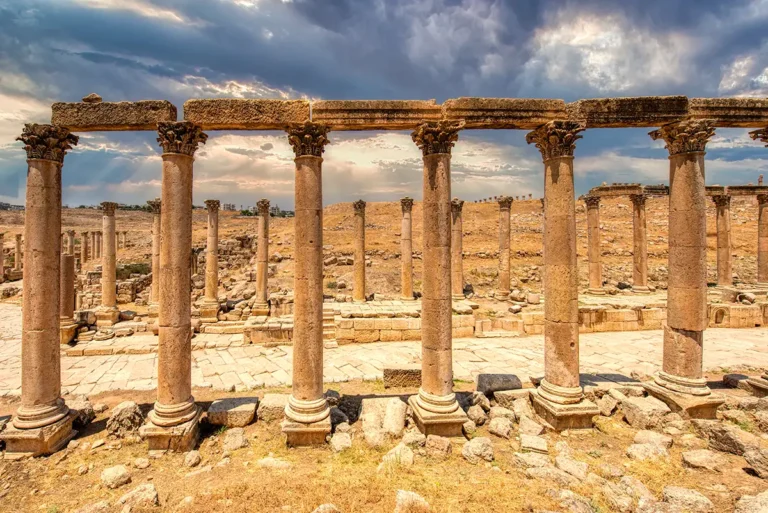
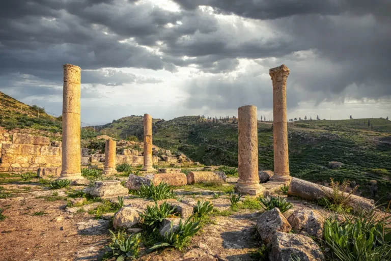
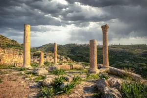
Columns once framed the Cardo along much of its length, creating covered porticoes on either side of the road. These colonnades gave shade and shelter, marked the boundary between traffic and pedestrian space, and created a grand visual rhythm that expressed the wealth of Gerasa.
The sidewalks beneath the porticoes led past shops, entrances and civic buildings. In a hot climate, these shaded edges would have been essential places for walking, meeting and conducting business. The Cardo was therefore divided into distinct zones: a central carriageway, pedestrian walkways and commercial or public spaces behind the columns.
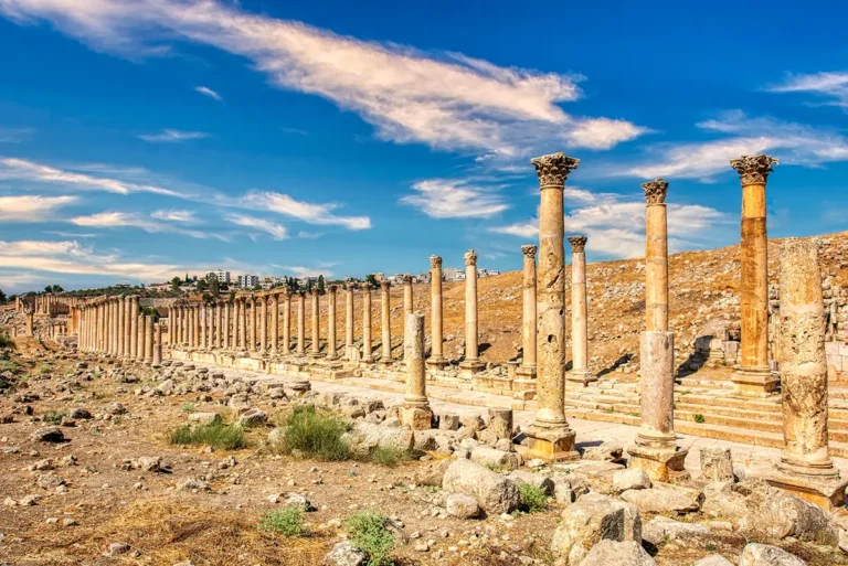
As you walk, notice that not every column is identical in preservation or placement. Some survive in their ancient positions; others have been re-erected during modern conservation. Together, they make the avenue’s original character readable while still revealing the long history of the site.
Drainage and Water Management
Beneath and beside the paving lay a practical drainage system. Openings along the street allowed rainwater to flow away from the surface and into underground channels. Stone covers, sometimes compared to manholes, gave access to parts of the system.
This infrastructure is easy to overlook, yet it was fundamental to the Cardo’s success. Heavy rain could rapidly move through the valleys and slopes around Jerash, and a monumental paved street required careful drainage to remain usable. The visible channels and openings show that Roman urbanism depended as much on hidden engineering as on columns and monuments.
Shops and Street Life
Behind the colonnades, many spaces opened directly onto the Cardo. Some were shops or workshops; others belonged to larger public, religious or residential complexes. Their exact functions changed over time, but their position beside the main street made them part of the city’s commercial and social life.
Imagine the difference between the Cardo as seen today and the ancient street at its height. The paving would have been busy, porticoes shaded by awnings or activity, shops displaying goods and public buildings announcing the city’s institutions. The street was both a route and a marketplace.
Tetrapyla and Intersections
The Cardo was crossed by east–west streets known as decumani. At important junctions, monumental four-sided structures called tetrapyla marked the intersections. These buildings helped organise movement and created visual landmarks along the long straight avenue.
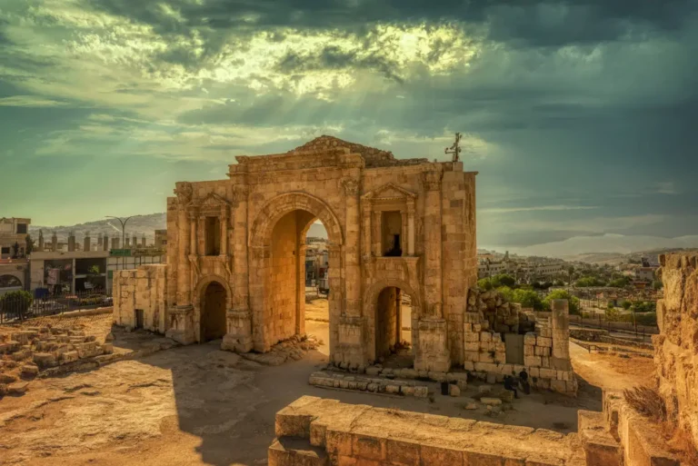
The North Tetrapylon, in particular, is a key point on the Cardo. It marks the junction with the North Decumanus and stands near the North Theatre. Such monuments transformed ordinary street crossings into formal civic spaces, reinforcing the city’s ordered Roman appearance.
Destruction, Rediscovery, and Restoration
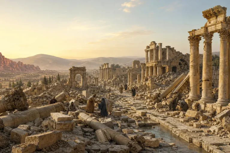
The Cardo Maximus suffered catastrophic damage during the historic Galilee earthquake of 749 AD. The violent horizontal tremors acted like a wave, toppling the massive stone pillars inward onto the roadway and shattering the limestone pavement. Over the subsequent centuries, silt and soil blowing from the surrounding hillsides buried the collapsed columns, creating a raised earthen valley that completely hid the original street level from view.
The avenue was systematically rediscovered by international archaeologists in the early 20th century. Clearing away the dense layers of soil revealed an astonishingly intact puzzle of fallen masonry.
Throughout the mid-and-late 20th century, the Jordanian Department of Antiquities launched a massive, multi-decade restoration campaign. Utilising the precise technique of anastylosis, engineers catalogued the scattered column drums, hoisted them back onto their original foundations, and cleared the original limestone paving slabs of centuries of packed earth. Today, the Cardo stands fully open, appearing remarkably close to its second-century layout.
What Happened on the Cardo?
The Cardo was the setting for the ordinary movement of urban life, but it also had ceremonial importance. Processions could pass between sanctuaries and public spaces; visitors entered the city through its gates; traders brought goods to shops and markets; and local residents used it as the main route through Gerasa.
It was also a place of display. The long colonnades, paving, monuments and intersections projected a clear message: Gerasa was a prosperous, organised and culturally confident city of the Roman East. The street made civic ambition visible in stone.
In late antiquity, the Cardo continued to function even as the city’s religious and social character changed. Christian churches were built nearby, older spaces were adapted and new forms of settlement appeared. The avenue’s survival through these changes reflects its importance as the city’s essential urban framework.
The Cardo and the Oval Plaza
The southern end of the Cardo meets the Oval Plaza, Jerash’s most distinctive public space. This connection is one of the great achievements of Roman planning in the city.
The Cardo is straight and strongly axial; the Oval Plaza is curved and expansive. Together, they solve the problem of linking the avenue with the differently aligned Sanctuary of Zeus. The plaza widens the route, redirects the visitor’s view and creates a ceremonial forecourt beneath the temple hill.
Walk north from the plaza and the Cardo carries you into the city. Walk south and the oval curve leads your eye back to the sanctuary. This relationship makes the two monuments best understood as parts of one larger urban composition.
Beyond the Cardo Maximus
The Nymphaeum
Along the Cardo stands the Nymphaeum, a monumental public fountain built in the late 2nd century CE. Its richly decorated façade once presented water as both a practical public resource and a sign of civic prosperity. The fountain illustrates how water, architecture and urban display worked together along Jerash’s main street.
The North Tetrapylon
The North Tetrapylon marked a major crossroads where the Cardo met the North Decumanus. Its four-sided form created a monumental landmark at the intersection and helped direct movement through the city. Nearby stands the North Theatre, adding another layer of civic architecture to this busy quarter.
The Temple of Artemis
West of the Cardo lies the Sanctuary of Artemis, dedicated to Jerash’s principal goddess. Its monumental propylon and stairways connect the street to one of the city’s most important sacred precincts. The relationship shows how the Cardo linked everyday movement with major religious destinations.
The Cathedral and Church Complex
Near the central part of the Cardo are the remains of the Cathedral and several Byzantine churches. These buildings reveal how the city evolved in late antiquity, when Christian institutions became prominent within the urban landscape once dominated by traditional Roman temples and civic monuments.
The North Gate
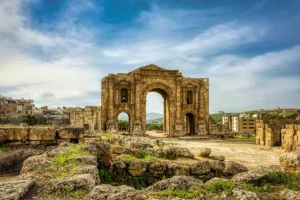
At the northern end of the Cardo, the North Gate formed a monumental entrance and exit for travellers using the road beyond the city. Reaching it gives a strong sense of the Cardo’s full length and of the scale of Gerasa’s planned urban core.
The Cardo Maximus Today
Today, the Cardo is the main walking route through the archaeological site. It remains a powerful experience because it allows visitors to move through Jerash as ancient residents did: on foot, along the city’s principal avenue, between its most important monuments.
The street is also used during cultural events and the Jerash Festival, when the ancient urban setting becomes active again with visitors, performers and ceremony. Even on a quiet day, the Cardo retains an unusual sense of continuity. The columns, paving and drainage are not isolated artefacts; they form the framework of a city that can still be read street by street.
Practical Visiting Tips
Start at the Oval Plaza and walk north at an unhurried pace. This direction allows you to experience the Cardo as a gradual journey into the city, with the Temple of Zeus behind you and the northern monuments ahead.
Wear comfortable shoes with a good grip. The ancient slabs are uneven, and the route is long enough that a slow walk can take 30–45 minutes, especially if you stop at the Nymphaeum, churches, markets or North Theatre.
Look down for wheel ruts and drainage openings, then look up for capitals, surviving entablature fragments and views framed by columns. The Cardo rewards both close observation and long perspectives.
Early morning and late afternoon offer the best light for photographs. The columns cast long shadows across the paving, making the line of the street and the grooves in its stones more visible. Carry water and sun protection, as shade is limited outside the porticoes.
Why the Cardo Maximus Matters
The Cardo Maximus matters because it is the key to reading Jerash as a city. It connects the Oval Plaza, sanctuaries, markets, theatres, churches, fountains, crossroads and gates into a single urban story. Without it, the monuments of Gerasa can seem separate; with it, they become parts of a coherent and living Roman landscape.
Its columns may be the most visible feature, but the paving, wheel ruts, drainage and shopfronts are equally important. Together, they show the two sides of Roman urbanism: public grandeur and practical everyday life. Walking the Cardo is one of the closest ways to experience the rhythm of ancient Jerash.
Frequently Asked Questions
In Roman town planning, the cardo was the principal north–south street. Cardo Maximus means the main or greatest cardo—the primary north–south avenue of the city.
The Cardo is approximately 800 metres long, or about 2,625 feet.
Yes. The grooves visible in parts of the limestone paving were formed by repeated ancient wheeled traffic, though the street has also undergone repair, restoration and weathering over many centuries.
They are part of the street’s drainage system. Water could flow from the surface into underground channels, helping to keep the paved road usable during rain.
Yes. The street was lined with porticoes, shops, workshops and entrances to public and religious buildings. It was one of the principal spaces for trade, movement and daily urban life.
Walk it from the Oval Plaza toward the North Gate. This route connects the major monuments in a logical sequence and reveals how the city was organised around its central avenue.
Key Moments in History
1st century CE — The main avenue takes shape: As Gerasa expanded under Roman rule, the Cardo Maximus developed as the city’s principal north–south street, organising movement through its growing urban centre.
106 CE — Gerasa joins the Province of Arabia: When the region was incorporated into the Roman province of Arabia, the city entered a period of major investment in roads, public buildings and monumental architecture. The Cardo became the framework linking these developments.
Key Moments in History
1st century CE — The main avenue takes shape: As Gerasa expanded under Roman rule, the Cardo Maximus developed as the city’s principal north–south street, organising movement through its growing urban centre.
106 CE — Gerasa joins the Province of Arabia: When the region was incorporated into the Roman province of Arabia, the city entered a period of major investment in roads, public buildings and monumental architecture. The Cardo became the framework linking these developments.
Early 2nd century CE — Colonnades transform the street: The avenue was lined with columns, porticoes and commercial frontages, turning a practical route into a grand civic promenade. The Cardo linked the southern sanctuary district with the northern parts of the city.
2nd century CE — The city’s monumental spine is completed: The street connected the Oval Plaza, markets, bathhouses, fountains, theatres, temples and major crossroads. Tetrapyla marked key intersections, while the Nymphaeum added a monumental public fountain along the route.
Late Roman and Byzantine periods — Continued use and adaptation: The Cardo remained central to city life as new churches, workshops and buildings appeared around it. Its paving, porticoes and drainage network continued to be maintained and reused.
749 CE — Earthquake damage: A major earthquake devastated Jerash, bringing down many columns and buildings along the Cardo. The street’s monumental character was severely damaged, and parts of the city were gradually abandoned or transformed.
Centuries of burial and reuse: Fallen columns, collapsed masonry and windblown soil covered sections of the avenue. Stone from older buildings was reused, while the once-busy street became part of a changing rural and later urban landscape.
20th century — Excavation and restoration: Archaeologists cleared the Cardo’s paving, drainage channels, shopfronts and fallen architectural elements. Selected columns were re-erected, restoring the long perspective that makes the avenue one of Jerash’s most memorable sights.
Today — The route through ancient Jerash: The Cardo Maximus remains the main walking route through the archaeological city. Its wheel ruts, paving slabs, columns and drainage openings provide a direct connection to the everyday movement and engineering of Roman Gerasa.