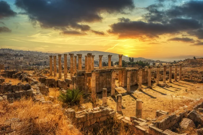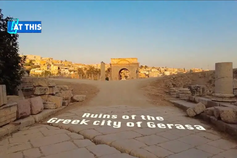
The South Gate is the historic threshold between the Roman city of Gerasa and the road south toward Philadelphia, modern Amman. Today it is the principal entrance to Jerash Archaeological Park, but its history is more complex than that of a simple city gate.
Built around AD 129–130 as a monumental triple-arched gateway, the South Gate originally stood in an open southern approach rather than in a defensive circuit. Only in the early 4th century AD was it incorporated into the long city wall that enclosed Jerash. This later change transformed a proud Roman entrance monument into a fortified gateway.
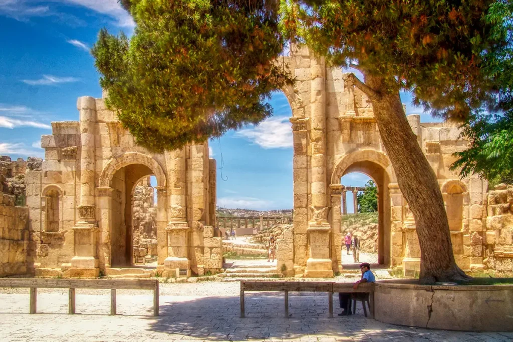
The South Gate and City Wall are best understood as one story of changing priorities: prosperity and monumental display in the 2nd century; insecurity, defence and controlled access in Late Antiquity.
The South Gate & The City Wall at a Glance
Location: Jerash Archaeological Park, Jordan (400 meters north of Hadrian’s Arch)
South Gate date: 129–130 AD
City wall date: Mainly early 4th century AD
Type: Monumental triple-arched city entrance, later incorporated into the defensive wall
Architectural order: Corinthian half-columns and richly articulated façades
Central arch: Approximately 4 metres wide
City-wall circuit: About 3.4 kilometres long
Historic road: The route south toward Philadelphia, modern Amman
Nearby sites: Hadrian’s Arch, Hippodrome, South Theatre, Sanctuary of Zeus, East Souk and South Street, West Souk and Military Barracks
Allow: 15–25 minutes, longer if following the wall and southern approach.
First Impressions
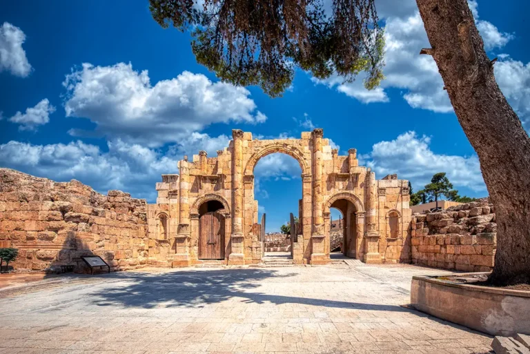
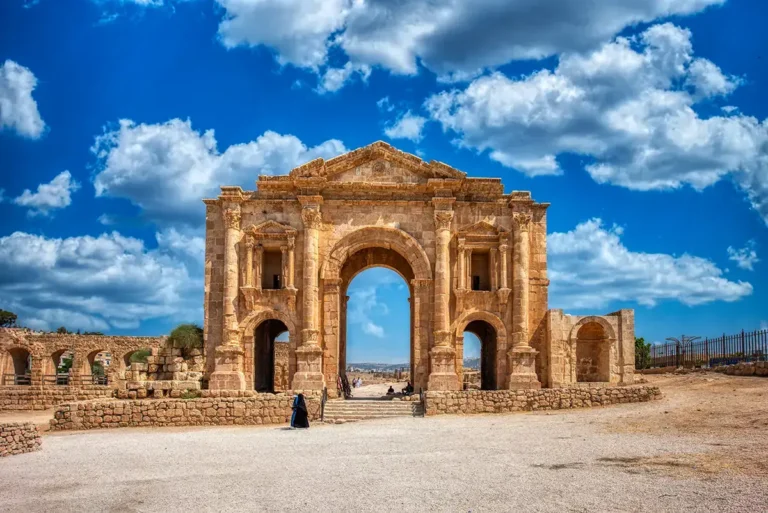
The South Gate feels more compact and purposeful than Hadrian’s Arch. Its three arches create an impressive façade, but the monument has the scale of a real urban threshold rather than a freestanding ceremonial landmark.
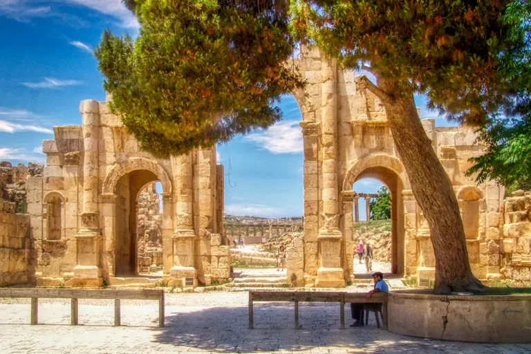
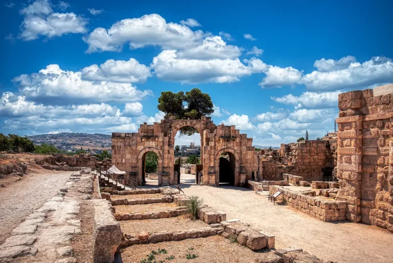
Stand on the southern side and look through the central passage. Beyond the gate, the road rises into the ancient city. The view gives a strong sense of arrival: this was the point where travellers left the road from Philadelphia and entered Gerasa’s streets, markets, sanctuaries and public buildings.
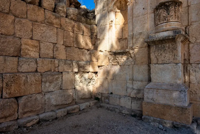
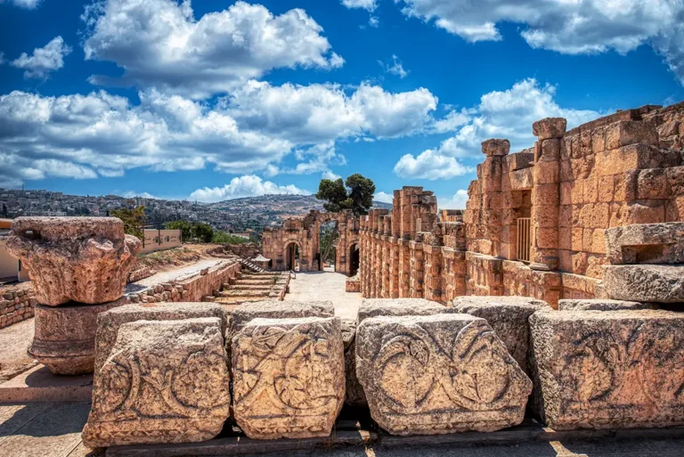
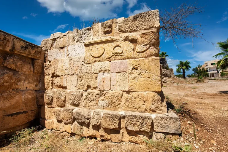
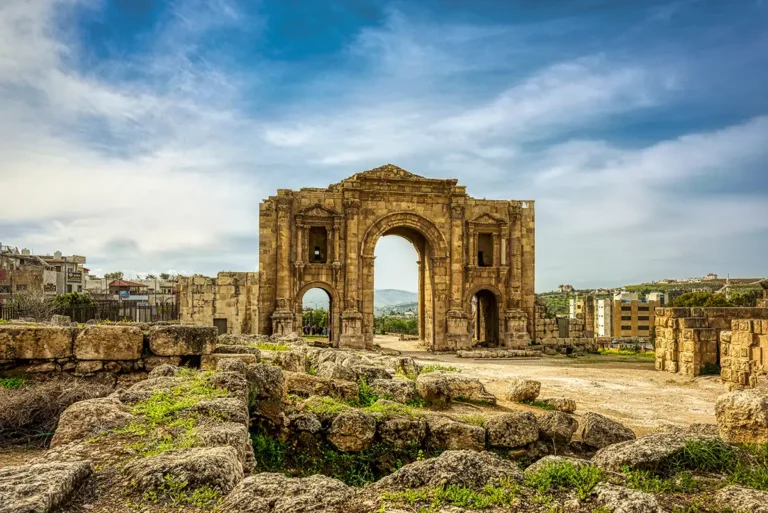
Look closely at the stonework. The gate combines broad arches with engaged Corinthian half-columns, mouldings and decorative details. Even after centuries of damage and restoration, it still communicates the civic confidence of Roman Gerasa.
Where Is the South Gate?
The South Gate stands at the southern end of the archaeological park, north of Hadrian’s Arch and the Hippodrome. It is reached from the modern visitor entrance and forms the usual first passage into the ancient city.
Its location followed the ancient road toward Philadelphia. Before the South Gate was built, the original entrance to Gerasa lay farther south, at a vaulted passage visible about 50 metres beyond the gate. From there, the road to Philadelphia began.
The monument marks a transitional landscape:
South: The road toward Philadelphia, the Hippodrome and Hadrian’s Arch
North: The South Theatre, Sanctuary of Zeus, Oval Plaza and central city
West: The West Souk, Oil Press and Military Barracks complex
East: The East Souk and South Street area
A Monumental Gate of AD 129–130
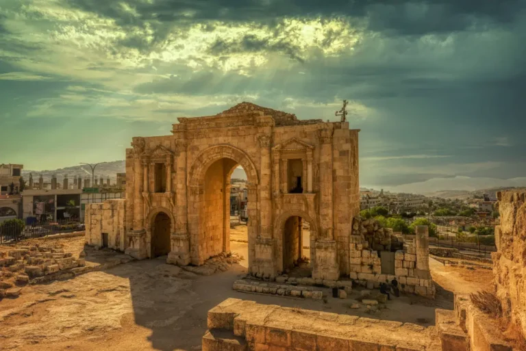
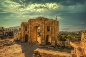
The South Gate was erected around AD 129–130, during the period of Emperor Hadrian’s visit to Gerasa. Its date and architectural character closely connect it with the larger Hadrian’s Arch farther south.
The official site interpretation notes the similarity between the two monuments: both have three archways framed by Corinthian half-columns. No surviving dedicatory inscription proves the South Gate’s exact purpose, but its design and date suggest that it may have been built shortly before Hadrian’s visit, possibly in his honour.
This makes the gate especially interesting. It was not a minor utilitarian opening; it was a carefully designed civic monument on one of Gerasa’s most important approaches. The Jordanian Ministry of Culture dates the South Gate to AD 129–130 and notes its three passages and Corinthian half-columns.
Architecture of the South Gate
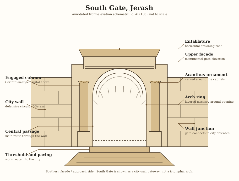
Three Archways
The gate has a broad central passage flanked by two smaller side arches. The larger central opening accommodated the main flow of traffic, while the side passages allowed pedestrians and lighter movement to pass through the monument.
This tripartite design gave the façade rhythm and balance. It also made the act of entering the city feel organised: the structure channelled movement without becoming a closed or cramped barrier.
Corinthian Half-Columns
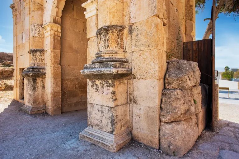
Engaged half-columns decorate the façade. Their Corinthian capitals, with their characteristic acanthus leaves, gave the gate the rich architectural language used throughout Roman Gerasa.
The columns did not stand free like those of a temple or collonaded street. Instead, they were attached to the wall, turning the surface of the gate into a layered architectural composition of projecting columns, arches, recesses and mouldings.
A Monumental Threshold
The South Gate was designed to be seen from the road. Its formal façade announced that a traveller had reached Gerasa, a prosperous city with a strong Roman identity.
At the same time, its passages had a practical role. People, pack animals, carts and goods could move through a formal opening in the urban boundary. Gates were places of arrival, departure, supervision and commerce—not merely decorative monuments.
The City Wall: A Later Addition
One of the most important facts about the South Gate is that it was not originally part of a city wall.
According to the official information board, Gerasa remained an open city until the beginning of the Byzantine period. Archaeological evidence has not confirmed an earlier defensive wall around the city.
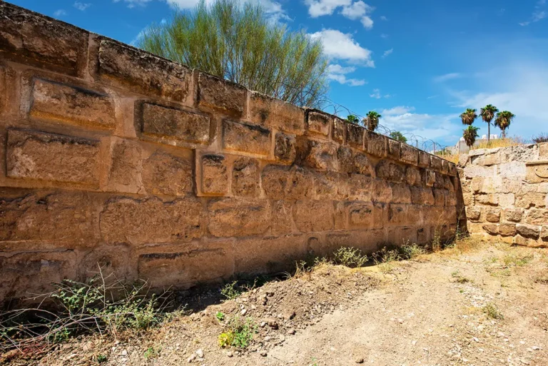
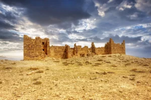
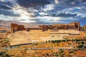
In the early 4th century AD, probably after a destructive raid and fire, a new wall about 3.4 kilometres long was built around Gerasa.
The South Gate was then incorporated into this defensive circuit. This sequence changed the meaning of the monument:
Around AD 129–130: A monumental Roman entrance on the southern road
Early 4th century AD: A fortified gate integrated into the city wall
Later centuries: A long-lived entrance within a changing Byzantine and early Islamic city
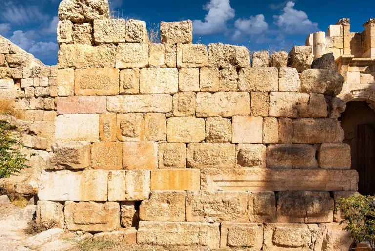
The wall was a major engineering project. It followed the terrain around the city, using substantial limestone masonry and defensive towers. At the South Gate, the wall converted a ceremonial entrance into a controlled access point.
Why Did Jerash Build a Wall?
The construction of the city wall reflects a wider change in the late Roman world. During the 2nd century, Gerasa could invest in public monuments, theatres, temples and open urban approaches. By the late 3rd and early 4th centuries, insecurity made defence more urgent.
The site interpretation associates the wall’s construction with a period after looters had burned and destroyed parts of the city. Although the exact circumstances remain difficult to reconstruct, the architectural result is clear: Jerash shifted from an open Roman city to one protected by a substantial defensive circuit.
The South Gate embodies that change. It retained its elegant Roman façade, but it acquired a new military importance as part of the wall.
South Gate, Hadrian’s Arch & the Southern Approach
The South Gate is best appreciated as part of a sequence of monuments rather than in isolation.
Hadrian’s Arch
Hadrian’s Arch stands farther south, beyond the Hippodrome. It was a ceremonial monument connected with Hadrian’s visit and perhaps with an unrealised plan to expand Gerasa southward.
The South Gate, by contrast, marked the practical entrance into the historic urban core. The arch celebrated imperial connection; the gate marked entry into the city.
The Hippodrome
Between the arch and the gate lies the Hippodrome, where chariot races and public spectacles took place. Its position meant that visitors approaching from the south encountered a sequence of large-scale Roman architecture before reaching Gerasa itself.
The Road to Philadelphia
The South Gate opened onto the route to Philadelphia, now Amman. This connection mattered commercially as well as ceremonially. It brought travellers, animals, goods and news into the city from the south.
Markets and Military Quarter
The South Gate stood beside active commercial and working districts, but these areas deserve their own stories.
East Souk & The South Street
East of the gate, the former East Souk developed as a roadside commercial strip before the South Gate was built. Later changes rerouted the street and created the South Street, which provided a more direct approach toward the Oval Plaza.
West Souk & Military Barracks
West of the gate, the West Souk contained partly rock-cut workshops, upper-floor dwellings and an olive-oil press installed around AD 220. After destruction in the late 3rd century, the area was levelled and reused as military barracks beside the newly fortified gate.
Together, these neighbouring sites show that the South Gate was never simply an isolated monument. It stood within a busy district of roads, commerce, industry and later defence.
What to Look For
The three arches: Compare the broad central passage with the smaller side openings.
Corinthian decoration: Look for the engaged half-columns and acanthus-leaf capitals.
Gate depth: Stand inside a passage to see how much masonry separates the city from the road beyond.
City-wall line: Trace the wall’s course away from the gate where visible.
The original entrance vault: Look south beyond the gate for the older vaulted passage, about 50 metres away.
The road sequence: Imagine approaching from Hadrian’s Arch, passing the Hippodrome and entering Gerasa through the gate.
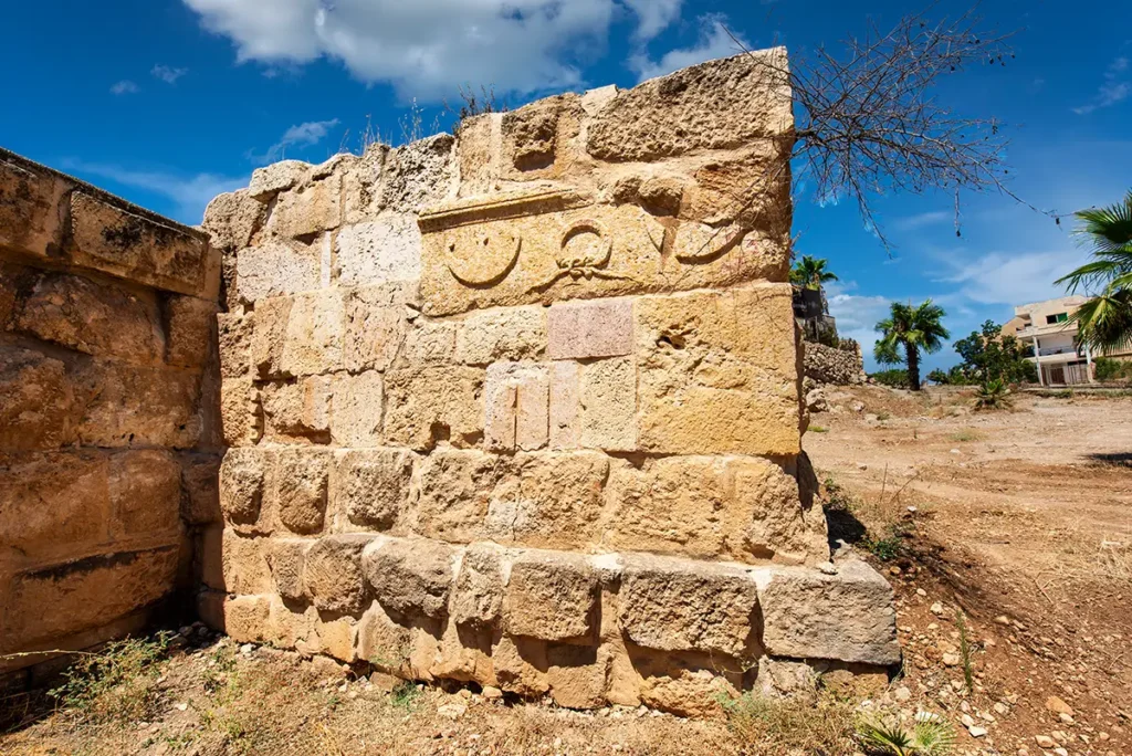
Changing stonework: Notice repairs, reused blocks and later defensive construction around the monument.
The South Gate Today
For modern visitors, the South Gate is both a major monument and the beginning of the Jerash experience. Passing through it recreates, in a small way, the movement of ancient travellers entering Gerasa from the southern road.
It also provides a useful correction to the idea that Roman cities were fixed and unchanging. The gate began as a monumental entrance in an open city, then became part of a defensive wall centuries later. Its meaning changed without its original architecture disappearing.
Practical Visiting Tips
Start at Hadrian’s Arch and walk north through the Hippodrome to approach the gate as an ancient visitor might have done.
Pause on both sides of the gate; the contrast between the southern approach and urban interior is part of the experience.
Allow extra time for the adjacent East Souk & South Street and West Souk & Military Barracks guides.
Visit in early morning or late afternoon, when low light reveals the depth of the arches and relief of the stonework.
Wear sturdy footwear; paving, curbs and nearby archaeological remains are uneven.
Do not climb on the gate, city wall or low archaeological foundations.
Combine the visit with the South Theatre, Temple of Zeus and Oval Plaza for a logical southern-to-central route through Jerash.
Frequently Asked Questions
The South Gate dates to around AD 129–130, during the period of Emperor Hadrian’s visit to Gerasa.
No. It was built first as a monumental entrance. It became part of the defensive wall only when the city wall was constructed in the early 4th century AD.
Both monuments use a triple-arched design with Corinthian half-columns and were built around the time of Hadrian’s visit. The site interpretation suggests that the South Gate may have provided a model for the larger arch.
The late-antique wall around Jerash was about 3.4 kilometres long.
No. Current archaeological interpretation indicates that Gerasa remained open until the early 4th century AD, when the city wall was built.
A vaulted passage about 50 metres south of the present gate marked the earlier entrance to Gerasa and the start of the road toward Philadelphia.
They are neighbouring but separate archaeological sites. The East Souk & South Street and West Souk & Military Barracks each have their own development history and are best explored through separate guides.
Key Moments in History
First-Century AD: The City Wall Takes Shape
Gerasa expanded rapidly under Roman rule. By the later first century AD, a defensive wall enclosed the main urban area, following the natural contours of the site and creating a protected boundary around streets, temples, houses, markets, and public buildings.
Around AD 130: The South Gate Is Built
The South Gate was constructed around AD 130 as the principal southern entrance into the walled city. It linked the road from Philadelphia, modern Amman, with the urban centre of Gerasa and formed part of the city’s larger defensive circuit.
Key Moments in History
First-Century AD: The City Wall Takes Shape
Gerasa expanded rapidly under Roman rule. By the later first century AD, a defensive wall enclosed the main urban area, following the natural contours of the site and creating a protected boundary around streets, temples, houses, markets, and public buildings.
Around AD 130: The South Gate Is Built
The South Gate was constructed around AD 130 as the principal southern entrance into the walled city. It linked the road from Philadelphia, modern Amman, with the urban centre of Gerasa and formed part of the city’s larger defensive circuit.
Second Century AD: A Busy Entrance District
The area around the South Gate became an active commercial zone. The East and West Markets contained shops and workshops serving residents, travellers, and traders entering the city. Their location close to the gateway made them ideal for trade, craft production, and everyday exchange.
Around AD 220: The Oil Press Is Installed
Part of the West Market was adapted for olive-oil production. The rocky floor of a southern shop was cut down to accommodate an oil mill and press, showing how commercial spaces could be transformed to meet changing economic needs.
Third Century AD: Commercial Change and Disruption
The southern market district underwent major change during the third century. Some earlier workshops and market structures were damaged, abandoned, or rebuilt, altering the character of the area around the gate.
Late Roman and Byzantine Periods: Defence Returns
As conditions changed, the city wall regained importance. The former West Market was levelled and reused for a small military barracks, allowing soldiers to monitor the South Gate and the nearby section of the defensive wall.
Byzantine Adaptation of the Wall
Jerash remained inhabited through the Byzantine period. Sections of the city wall were repaired, strengthened, and incorporated into the changing urban landscape, while churches, workshops, houses, and reused Roman structures reshaped the city inside its boundaries.
Modern Archaeology and Conservation
Excavation and conservation revealed the South Gate’s relationship to the city wall, markets, oil press, and barracks. These remains now show visitors that Gerasa was not only a city of temples and theatres, but also a defended, working, and evolving urban community.
Today: A Threshold into Ancient Jerash
The South Gate remains one of the clearest places to understand how ancient Jerash functioned. It marks the transition from the ceremonial southern approach into the walled city, while the surrounding remains preserve evidence of trade, industry, military activity, and daily life.