
Qal’at Al-Hasa
An Ottoman Hajj fort of 1760 beside the old bridge over the flood valley of Wadi al-Hasa
BuiltAD 1760
BridgeAD 1730–33
Location140 km S of Amman
AccessFree · daylight visits
Introduction
The crossing of Wadi al-Hasa was one of the most dangerous on the pilgrim road.
Wadi al-Hasa was one of the most dangerous crossings on the pilgrim road: its winter floods could sweep away men and animals. In 1730–33 the governor of Damascus, Abdullah Pasha al-Aydinli, had a bridge and a paved road built across it, and in 1760 a fort with a reservoir followed to guard the crossing.
The fort stands on the south bank of the wadi beside the Desert Highway, about 140 km south of Amman. Entry is free; visit during daylight, as access to the interior is not guaranteed. See the courtyard with its well housing, the reservoir and the old bridge and road over the wadi.
Best timeOct–Apr
Time needed30 min
TicketFree
From Amman140 kmAbout 1 hr 45 min
Combine withKhirbet edh-Dharih · 50 min
Google rating4.0 · Reviews
Highlights · A Hajj fort
A fort, a well and a bridge
Five things to look for at Qal’at Al-Hasa
Al-Hasa is a quiet stop on the Desert Highway. These are the places that make the visit.
 01 / 05
01 · Defence
The fort walls
The fort
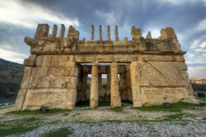
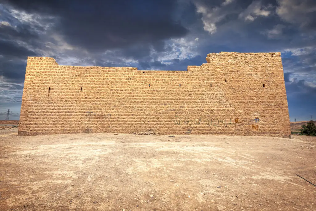
The north wall is of fine ashlar; the others are of rougher limestone, with towers at the corners.
Look closely
The gun slits in the walls.
1 of 5
Part by part
What to see
Four parts of the visit: the fort, the courtyard and rooms, the reservoir and the bridge. Pick one to see what to look for.
1 / 601 · On the south bank
Walk round the fort
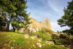
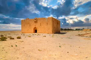
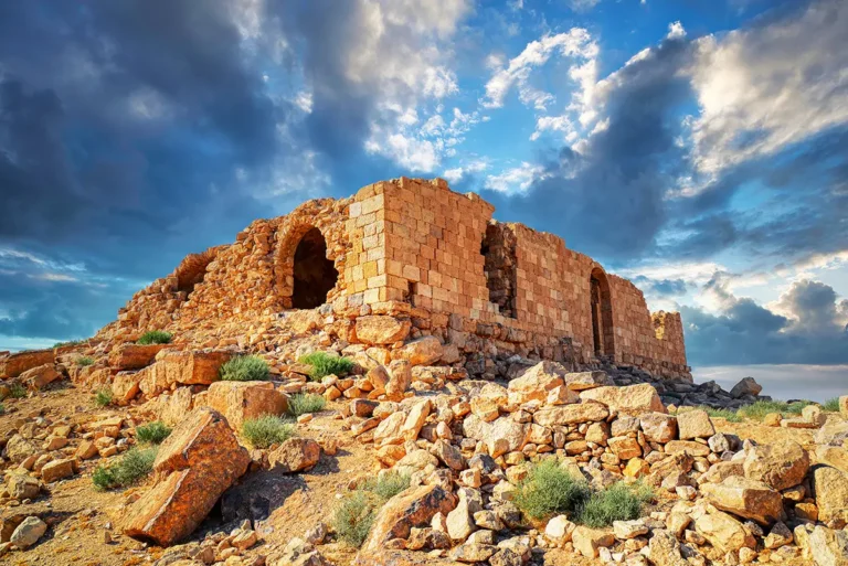
The gate lies in the middle of the south wall, under a pointed vault. The north wall is of fine ashlar; the others are of rougher limestone. Towers stand at the corners, and slit windows and gun slits pierce the walls.
The fort was restored in the late 1980s and early 1990s, when the south wall was partly rebuilt.
AD 1760Corner towersGun slits
Look for
- The fine ashlar of the north wall
- The gate under a pointed vault
- Slit windows and gun slits
 1 / 9
02 · Inside the fort
Explore the courtyard
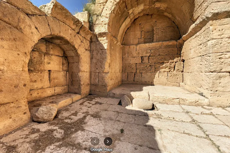
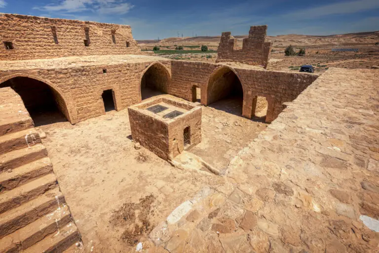
The gate leads to a courtyard 12.5 m square, with a tall structure over a well about 10 m deep at its centre. Nine rooms surround the courtyard on the ground floor.
On the first floor, the southern range has barrel-vaulted rooms on either side of a central iwan with a plain mihrab, where a building inscription, now lost, recorded the fort’s construction in 1760 under Sultan Mustafa III.
12.5 m courtyard10 m wellMihrab iwan
Look for
- The well housing in the courtyard
- The stairs to the first floor
- The plain mihrab in the iwan
Dig deeperGenerations of guards
In the 1860s travellers found guards whose families had lived here for generations, tending a small garden between the fort and the cistern.
 1 / 5
03 · Water for the caravan
See the reservoir
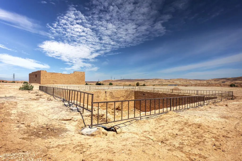
A plastered reservoir about 20 m square, with steps in one corner, lies 50 m east of the fort. An underground channel links it to the courtyard well.
The reservoir is fenced today; view it from the edge.
About 20 m squareUnderground channel
Look for
- The steps in one corner
- The plastered walls
- The fort seen from the reservoir
 1 / 7
04 · Over the flood valley
Find the old bridge
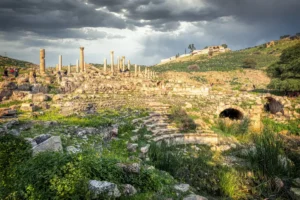
Because flash floods in the wadi were often deadly, Abdullah Pasha al-Aydinli had a two-arched bridge and a paved approach road built in 1730–33 to carry the caravan safely over the flood channel. They are the oldest structures on the site.
In 1779 the traveller Mehmed Edib described the bridge, fort and cistern.
AD 1730–33Two archesPaved road
Look for
- The arches of the bridge
- The paving of the Ottoman road
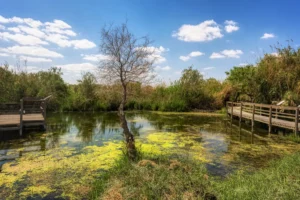
- The green fields of the wadi
Dig deeperThe railway and the Revolt
The Hejaz Railway passed al-Hasa in the early 20th century, about 5 km south-east of the fort. In 1918 Arab forces captured and destroyed the railway station.
History & significance
Guarding the crossing
Al-Hasa was a halt on the Hajj road from the 16th century. The Ottomans bridged the wadi in the 1730s and built the fort in 1760; the Hejaz Railway passed nearby in the 20th century.
- AD 1563Al-Hasa appears as a Hajj halt
- AD 1730–33The bridge and paved road are built
- AD 1760The fort is built under Sultan Mustafa III
- AD 1779Mehmed Edib describes bridge, fort and cistern
- AD 1918Arab forces capture the railway station
- Late 1980s–1990sThe fort is restored
 ProfileQal’at Al-Hasa: the full storyThe history, the bridge and the architecture of Qal’at Al-Hasa.Read the profile →
Plan your visit
Everything you need to know before you go
The fort stands on the south bank of Wadi al-Hasa beside the Desert Highway, about 140 km south of Amman, in Tafila Governorate. The Hejaz Railway station of al-Hasa is about 5 km to the south-east.
Good to know: visit during daylight; access to the interior is not guaranteed. The stairs to the first floor are steep, and the reservoir is fenced.
Opening hoursOpen siteVisit during daylight
Entry ticketFreeNo ticket office
Time to visit30 minAbout 30 minutes for the fort, reservoir and bridge
From Amman140 kmAbout 1 hour 30 to 1 hour 45 by the Desert Highway
LocationDesert Highway30.8393° N, 35.9337° EGet directions
Opening hours and prices checked October 2026. Spotted a change? Let us know
Facilities by location
Near the entrance
No designated parking
Access: No 4x4 needed.
When to go
October to April is best. Summer days are very hot, and after heavy winter rain the wadi can flood.
J
F
M
A
M
J
J
A
S
O
N
D
BestGood, cooler or warmVery hot
Tip: walk down to the bridge: few visitors see it, and it is the oldest part of the site.
Before you go
There are no services at the site.
- WaterNo shade and no services
- Sun hat and sunscreenEspecially from May to September
- Good shoesRubble and uneven floors
- The map pinSigns are few or missing
Common questions
Quick answers before you set off.
Is there an entrance fee?
No. Entry to Qal’at Al-Hasa is free.
Can I go inside?
Access to the interior is not guaranteed. When the fort is open you can walk round the courtyard and climb to the first floor.
Is the bridge Roman?
No. The two-arched bridge and paved road were built by the Ottomans in 1730–33, for the Hajj caravan.
How long do I need?
About 30 minutes for the fort, the reservoir and the bridge.
Combine with
Al-Hasa lies between Qatrana and Ma’an, near the Nabataean temples of Wadi al-Hasa. Drive times are from Qal’at Al-Hasa.
Explore this site
More from Qal’at Al-Hasa
Panoramas, walk-throughs, photos and stories about this site.
ProfileQal’at Al-Hasa: history & architecture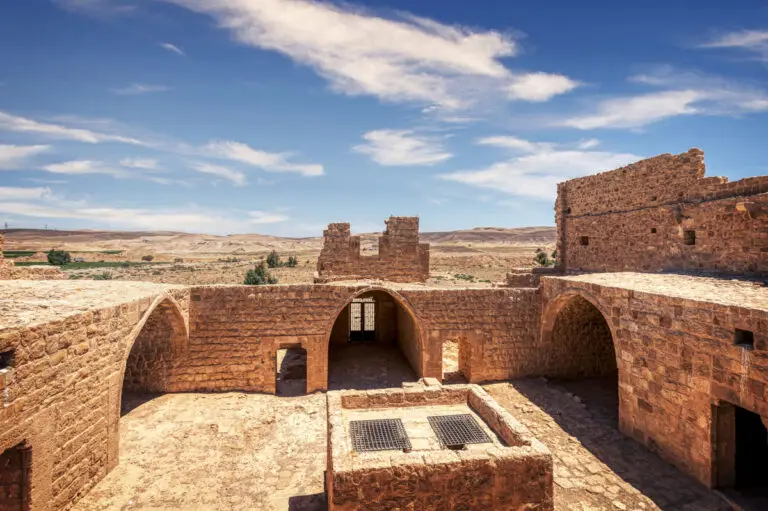 Photo albumQal’at Al-Hasa: A Hajj Fort and Ottoman Bridge in Photos
 360°360° panoramaAl-Hasa Ottoman Train Station: 360° Panorama
Nearby
Also in the south
From guide to visit
Explore the Hajj forts with a private guide
Tell us when you’d like to go, and we’ll plan a private day along the old pilgrim road, with door-to-door transport.