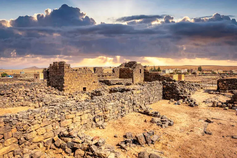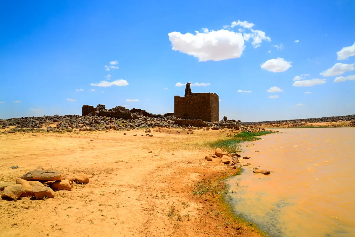


Far out in the black basalt desert of north-eastern Jordan, a square tower rises beside a lake. Qasr Burqu began as a late Roman lookout and was enlarged by an Umayyad prince, and its water has drawn herders, travellers and birds for thousands of years.
Where Is Qasr Burqu?
Qasr Burqu lies in Mafraq Governorate, where the black basalt harra meets the flint desert, about 200 km east of Amman in a straight line. From the Baghdad highway, a desert track turns north just before Ruwaished and runs about 18 km to the site; the drive from Amman takes about three hours. The qasr lies inside the Burqu Nature Reserve, managed by the RSCN.
Historical Context and Origin
People came to the water at Burqu long before any building: herders of the Late Neolithic left many traces around it. The oldest part of the qasr is a square basalt tower, generally dated to the late Roman or Byzantine period, perhaps a frontier lookout; it may later have housed a monastic community. In AH 81 (AD 700) the Umayyad prince al-Walid, son of Caliph ʿAbd al-Malik and caliph himself from 705 to 715, enlarged it, as a building inscription records. Bedouin continued to camp here in later centuries.
Architectural Design
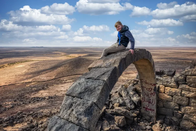
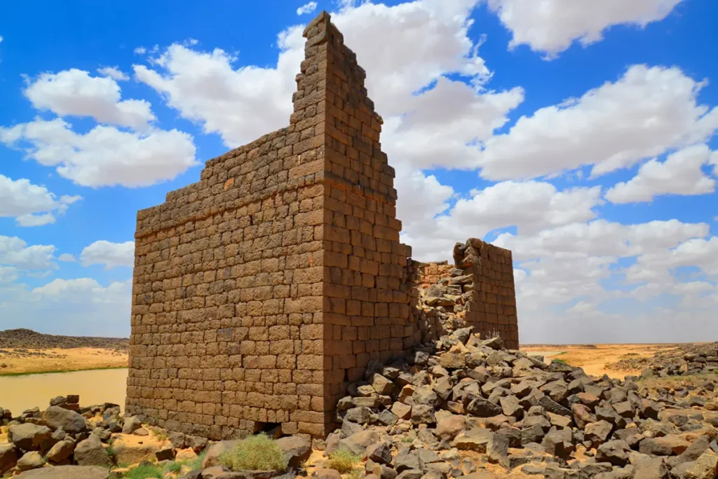
The tower stands inside a courtyard enclosure ringed by partly collapsed rooms. Its walls survive to about 5 m, from an original height estimated at about 13 m. Among the rooms are a long hall and a small apsed room with a pointed arch and side niches, read as a reception room or chapel. A cistern in the courtyard is attributed to the Umayyad phase. As the archaeologist Svend Helms put it, Burqu is “neither a castle, nor in the desert”: it stands in steppe, beside water.
The Tower
A square basalt tower, the oldest part of the site.
Al-Walid’s Inscription
A Kufic inscription of AH 81 (AD 700) names the future caliph al-Walid.
The Lake
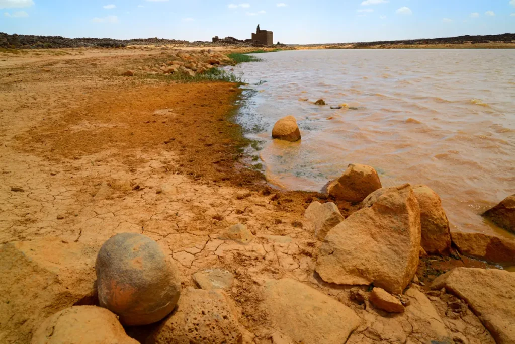
A shallow reservoir that fills with winter rain, held today by a modern dam.
Desert Wildlife
Birds and raptors gather at the water in the Black Desert.
Al-Walid’s building inscription
Three lines in early Kufic script on a basalt block found among the ruins.
The amir al-Walid, son of the Commander of the Faithful, ordered the building of these houses, in the year 81. (Summary.)
Published by Henry Field (1929, full tracing 1960).
The Lake of Burqu
Winter rain from the surrounding basalt drains into a shallow basin beside the qasr, forming a lake known as the Ghadir Burqu. A stretch of an old dam survives north of the qasr, and a modern earth dam further north now holds the water; in wet years it reaches the walls. The lake is an Important Bird Area, where raptors such as the long-legged buzzard and desert larks can be seen. Since 2020 the area has been part of the RSCN Burqu Nature Reserve.
Destruction, Rediscovery, and Restoration
Henry Field photographed the Arabic inscription in the 1920s and published a full tracing in 1960. The site was studied again in the 1970s, surveyed by Svend Helms (published 1991) and Alison Betts, and is the subject of new research by Claudia Bührig. It has not been restored.
Visiting Qasr Burqu Today
The ruins are free to visit, with no facilities nearby. Come by 4×4 with plenty of water; no permit or escort is needed. Allow about 40 minutes at the site. See our Qasr Burqu travel guide for directions.
Further reading: Helms, A New Architectural Survey of Qasr Burqu’ (Antiquaries Journal 1991); Bührig, Qasr Burqu (Archaeology in Jordan 4); BirdLife — Burqu’ Important Bird Area.